What We Capture
- Existing ground surfaces for design and estimating
- Stockpile and cut and fill volumes
- Monthly progress captures and orthophotos
- Point clouds of plants, structures and tunnels
- Profiles, sections and models for clash checks and as-builts
Drones and Conventional Survey Together
Drones cover large and difficult terrain quickly and safely. Conventional survey still gives the check shots and the reliability. We use both, so the surface you estimate from is one you can trust.
On the Mountainview townhouse project in Abbotsford, that balance produced rock quantities based on buildability, not theoretical volumes from the plans. At Gibraltar Mine, drones let us survey dangerous slopes around the new crusher quickly and safely.
How It Works
- Control firstWe set or tie into site control and place ground control and check points.
- Fly or scanDJI Mavic 3 Enterprise with PPK to a Trimble base, or terrestrial scanning with a Trimble SX10, depending on the site.
- ProcessPix4Dmatic and Trimble Business Center, checked against conventional survey shots.
- DeliverSurfaces, volumes and drawings in CAD, plus a browser link to view and measure the point cloud.
See It in Your Browser
Clients view and measure their scans in our Client Portal. No software to install: open the link, measure distances, areas and volumes, and download the full LAS or LAZ file.
Drone and Scanning Work
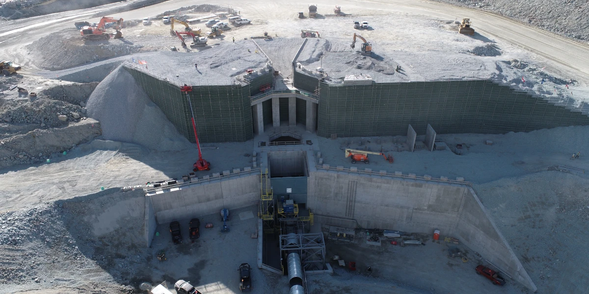 Gibraltar Mine New Rock CrusherSurveying for the installation of Gibraltar Mine's new rock crusher: topographic surveys of the surrounding terrain, volume measurement and wall alignment.Read the project
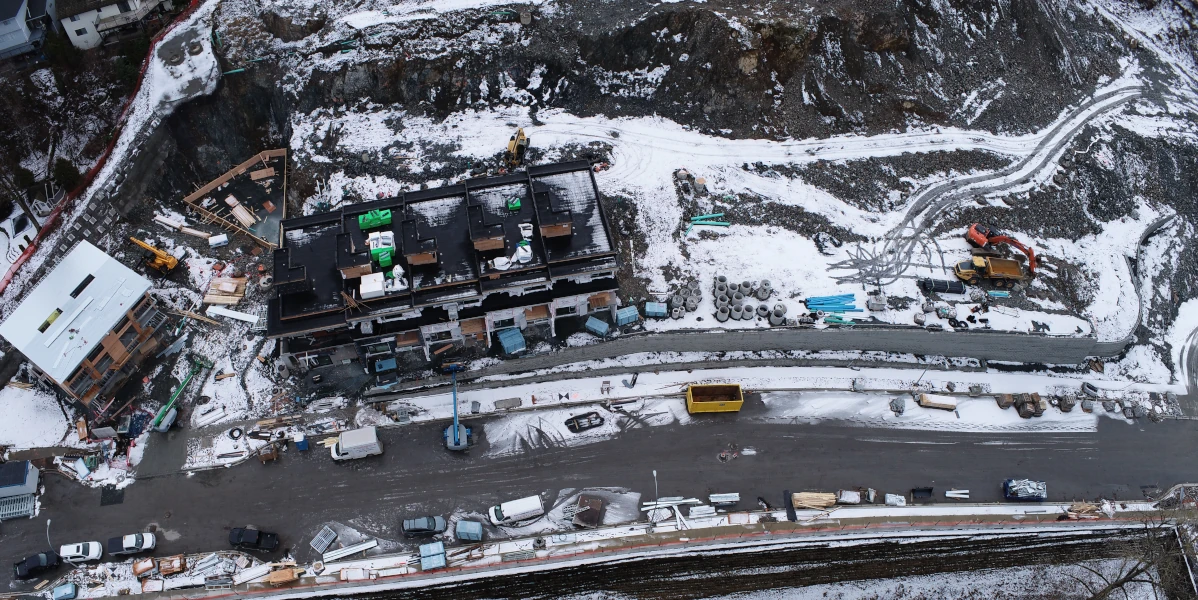 Mountainview Townhouse ProjectDrone surveying to produce accurate data for material removal on a townhouse development, plus cinematic drone video for marketing.Read the project
Questions
Drone Mapping Questions
How accurate is drone mapping?
Accuracy depends on ground control, flight height and the surface. We check every surface against conventional survey shots and report the result with the deliverable.
Can you fly near the airport or in the city?
Our pilot holds a Transport Canada Advanced certificate, which allows flights in controlled airspace with NAV CANADA authorization. We plan airspace and site permissions before the flight.
What file formats do you deliver?
Civil 3D and AutoCAD drawings, surfaces, orthophotos, LAS or LAZ point clouds, and PDF reports. Tell us what your team uses.
Is drone or laser scanning better for my site?
Drones suit open sites, stockpiles and large areas. Laser scanning suits buildings, plants, tunnels and detail work. Many projects use both.
Can you do monthly progress captures?
Yes. Regular captures on the same control give you comparable surfaces and volumes month to month.
Service Area
Based in Langley. Working Across BC and Alberta.
Our Langley crews cover Metro Vancouver, the Fraser Valley and the Sea to Sky. Our Edmonton office covers Alberta. We also travel to mine, industrial and remote sites across both provinces.
- Vancouver
- Burnaby
- Richmond
- Delta
- Surrey
- Langley
- Abbotsford
- Chilliwack
- Hope
- Maple Ridge
- Coquitlam
- Port Moody
- Port Coquitlam
- North Vancouver
- West Vancouver
- Squamish
Related services
Need a Surface or Volume?
Send the drawings, site address and dates. We'll come back with a scope and price.